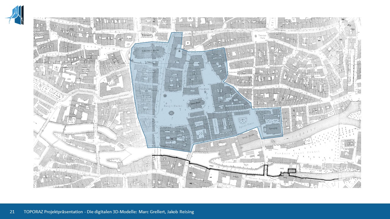
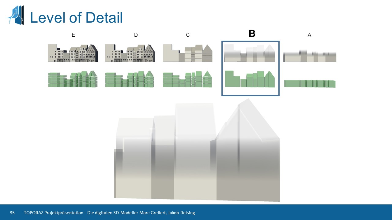
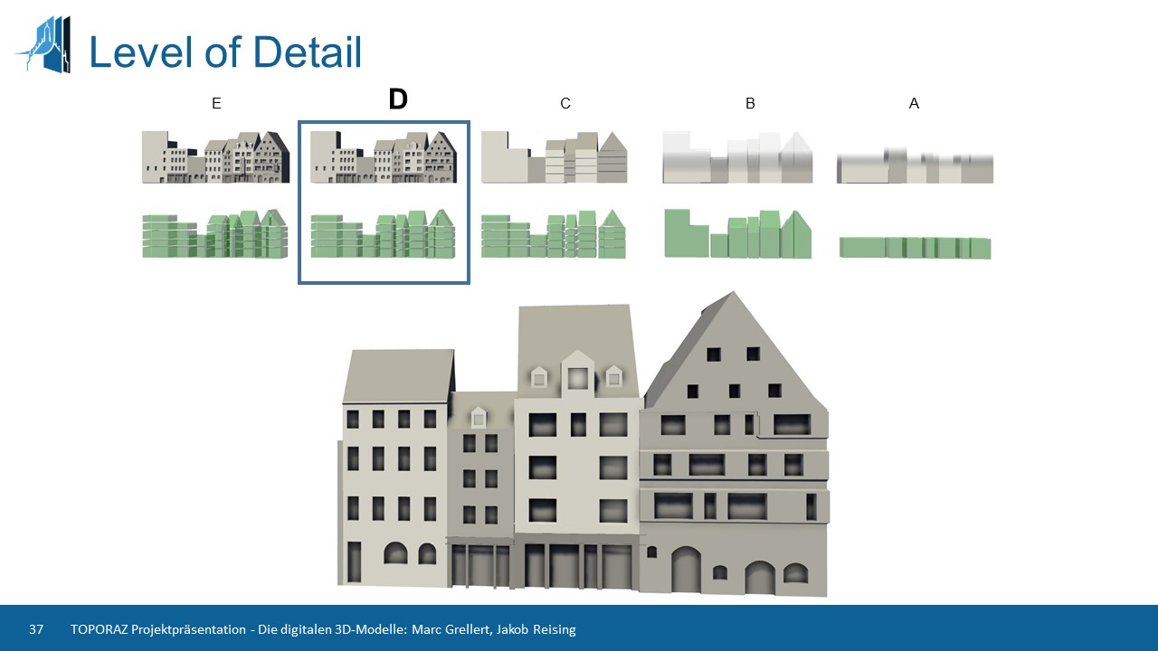
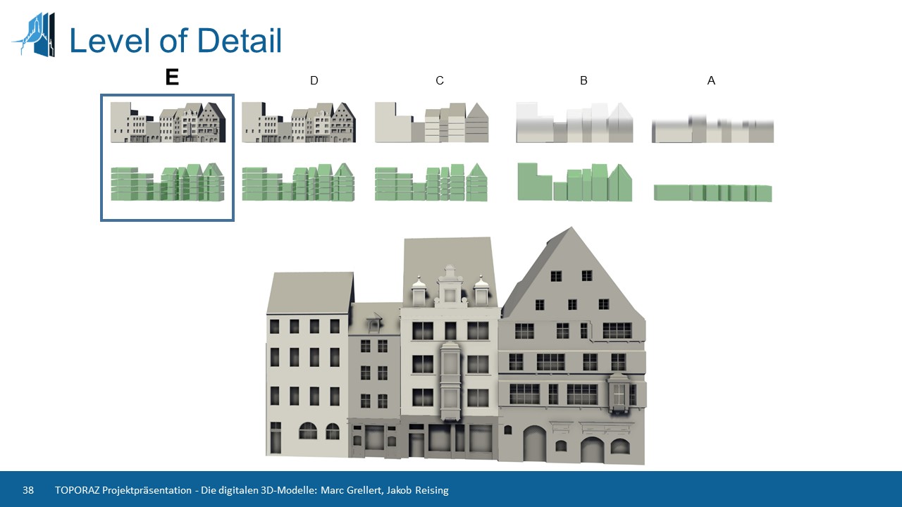
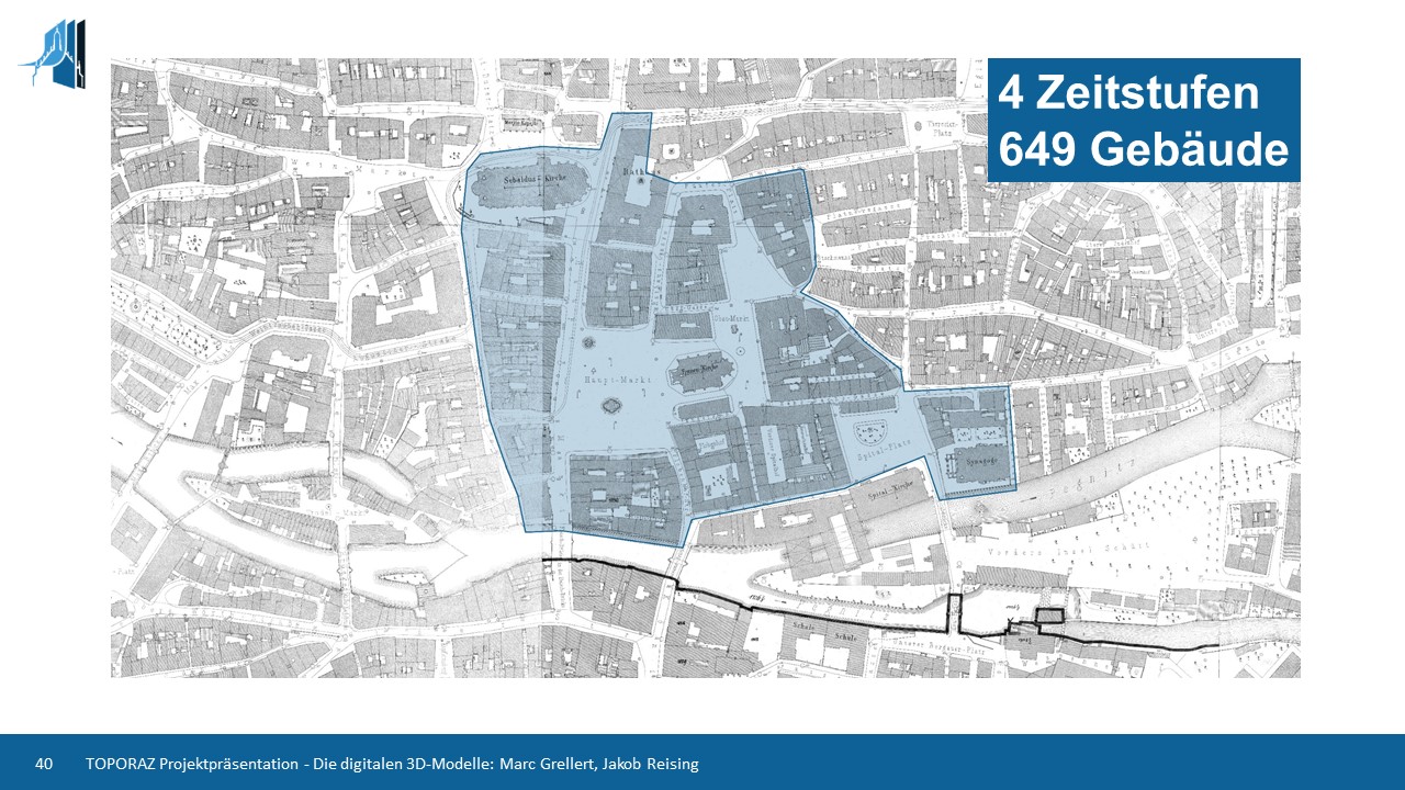
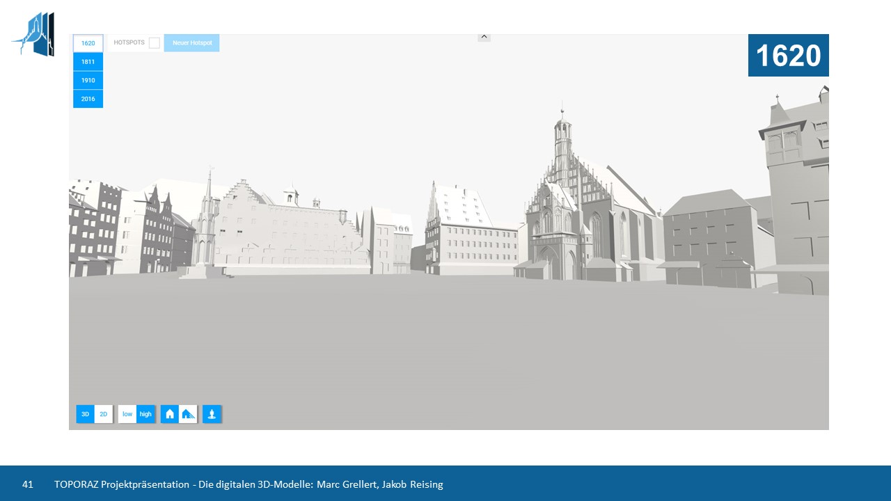
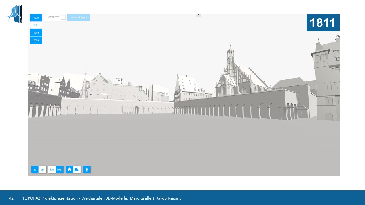
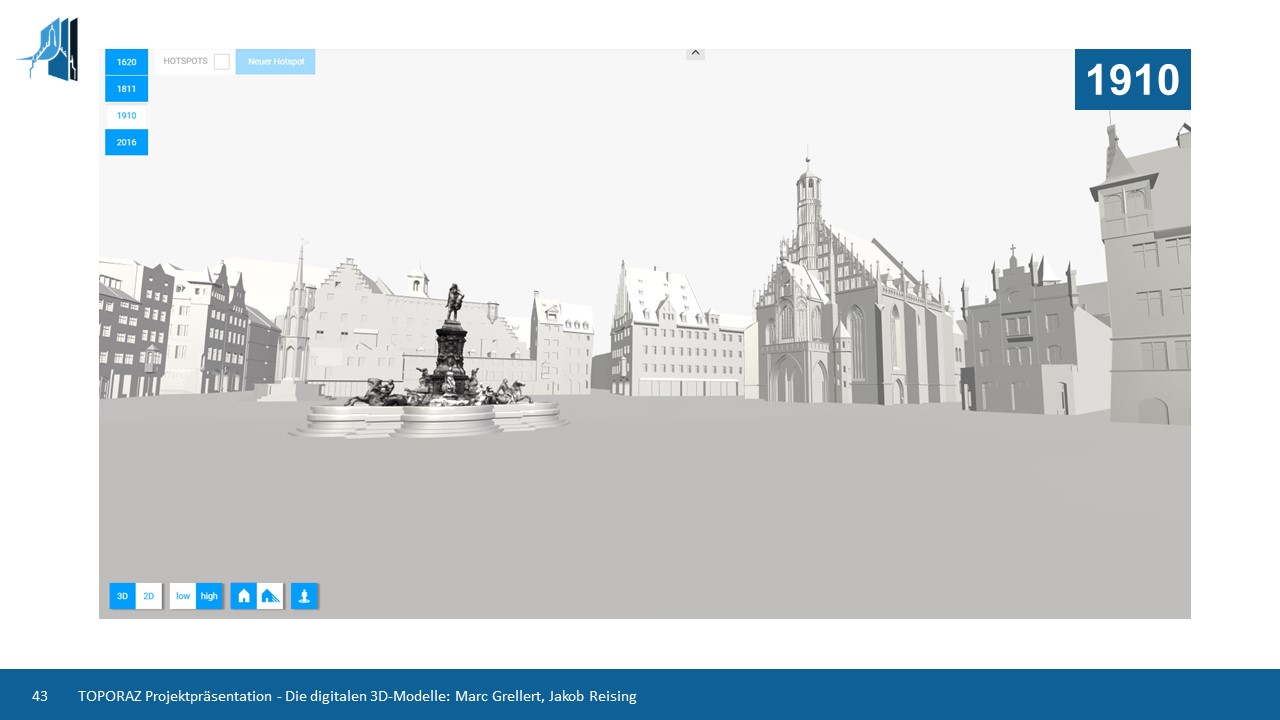
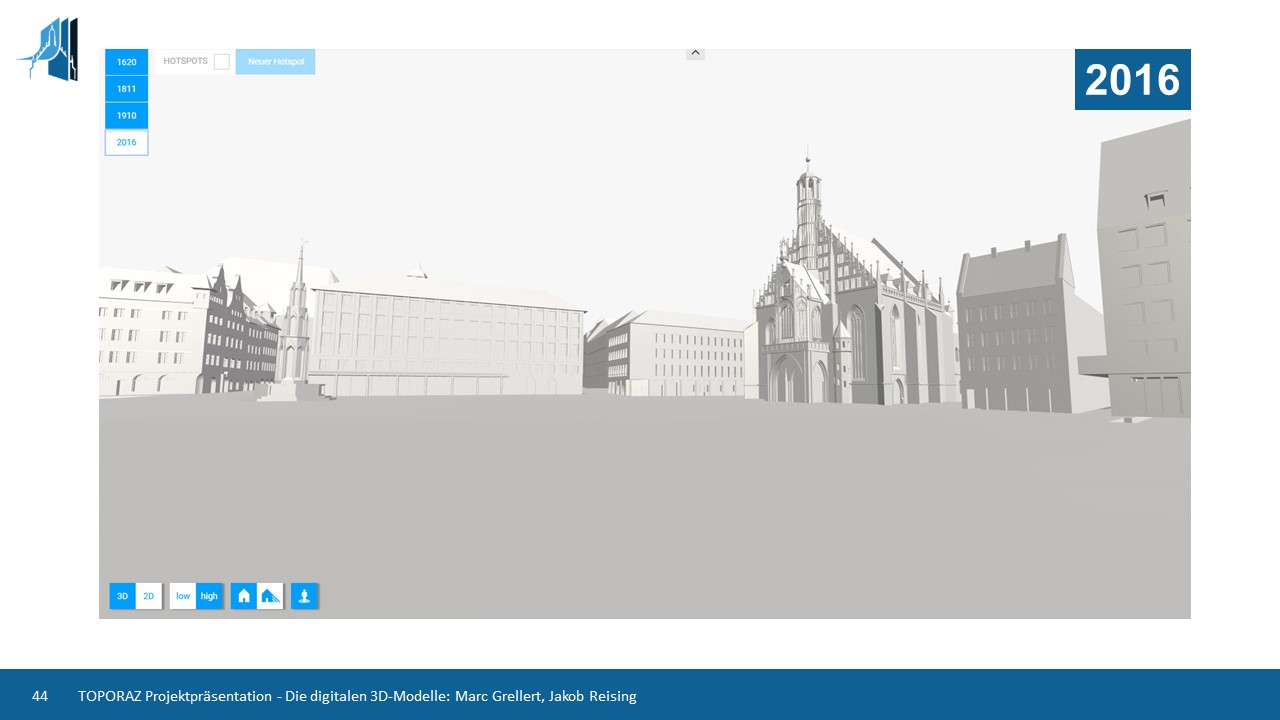
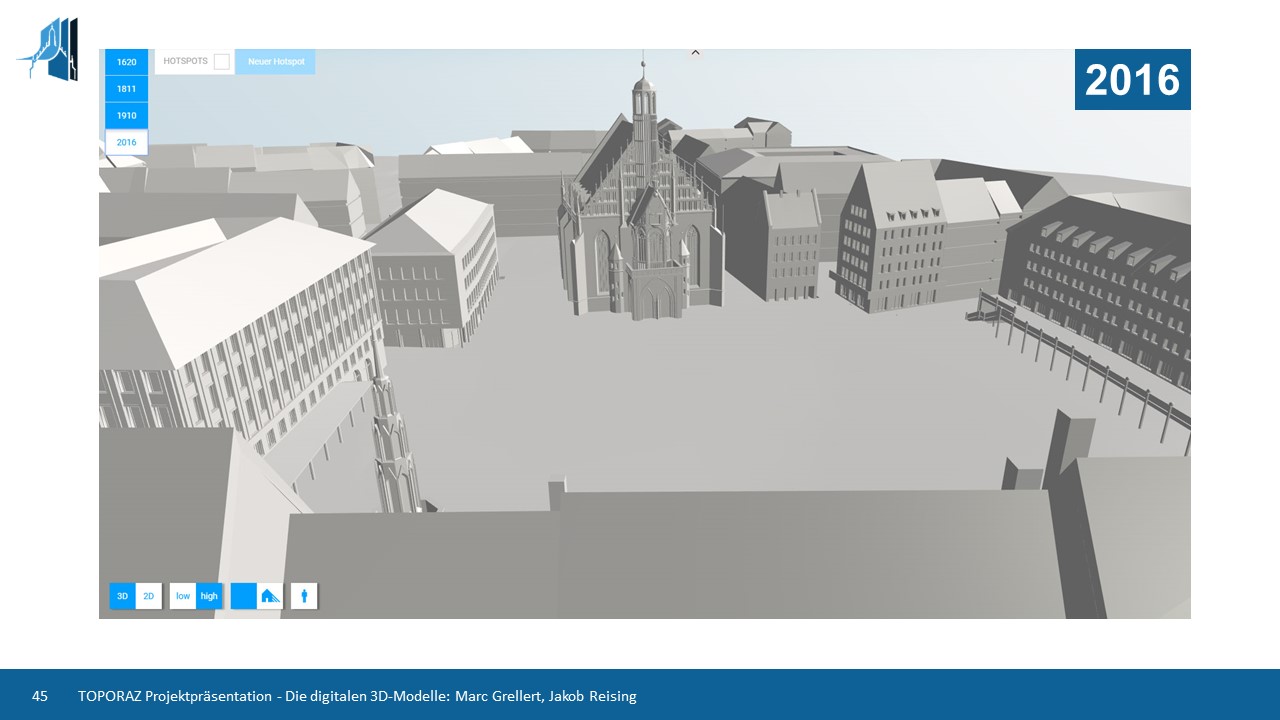
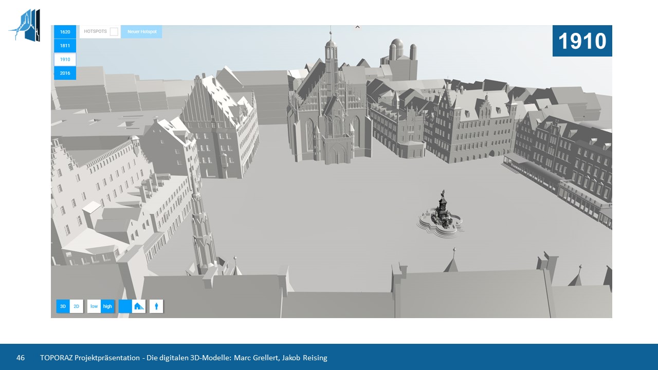
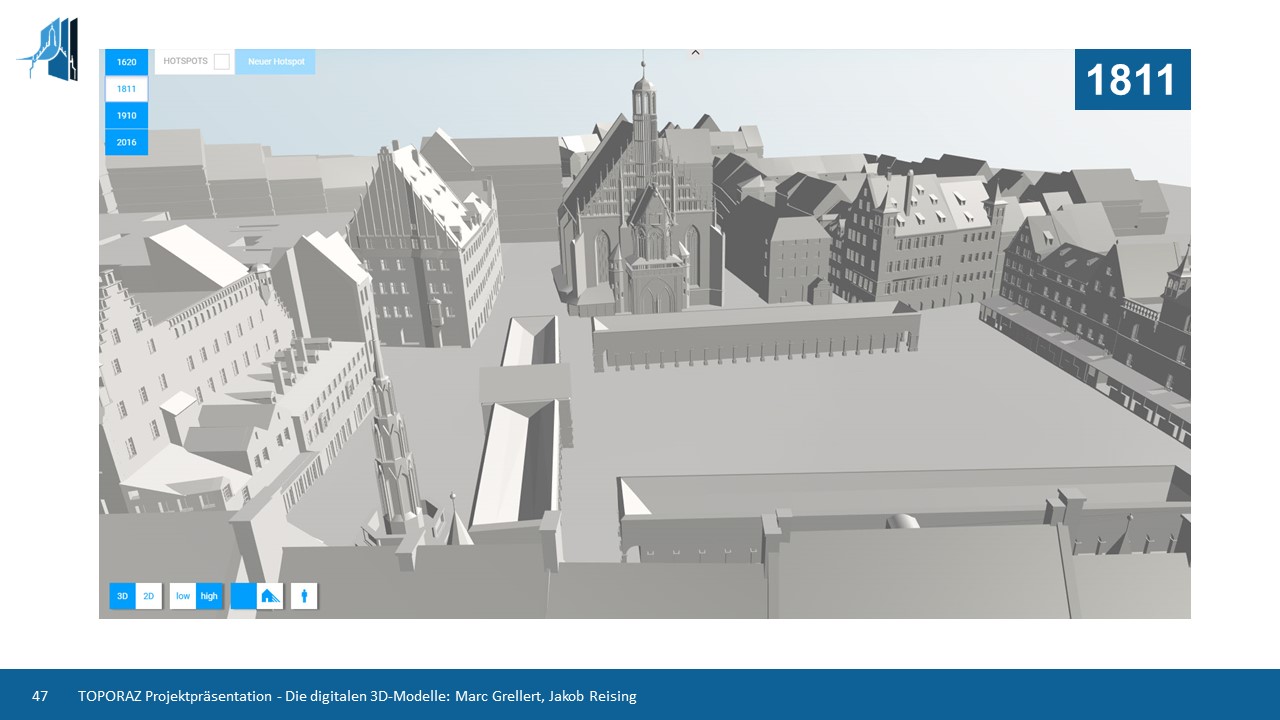
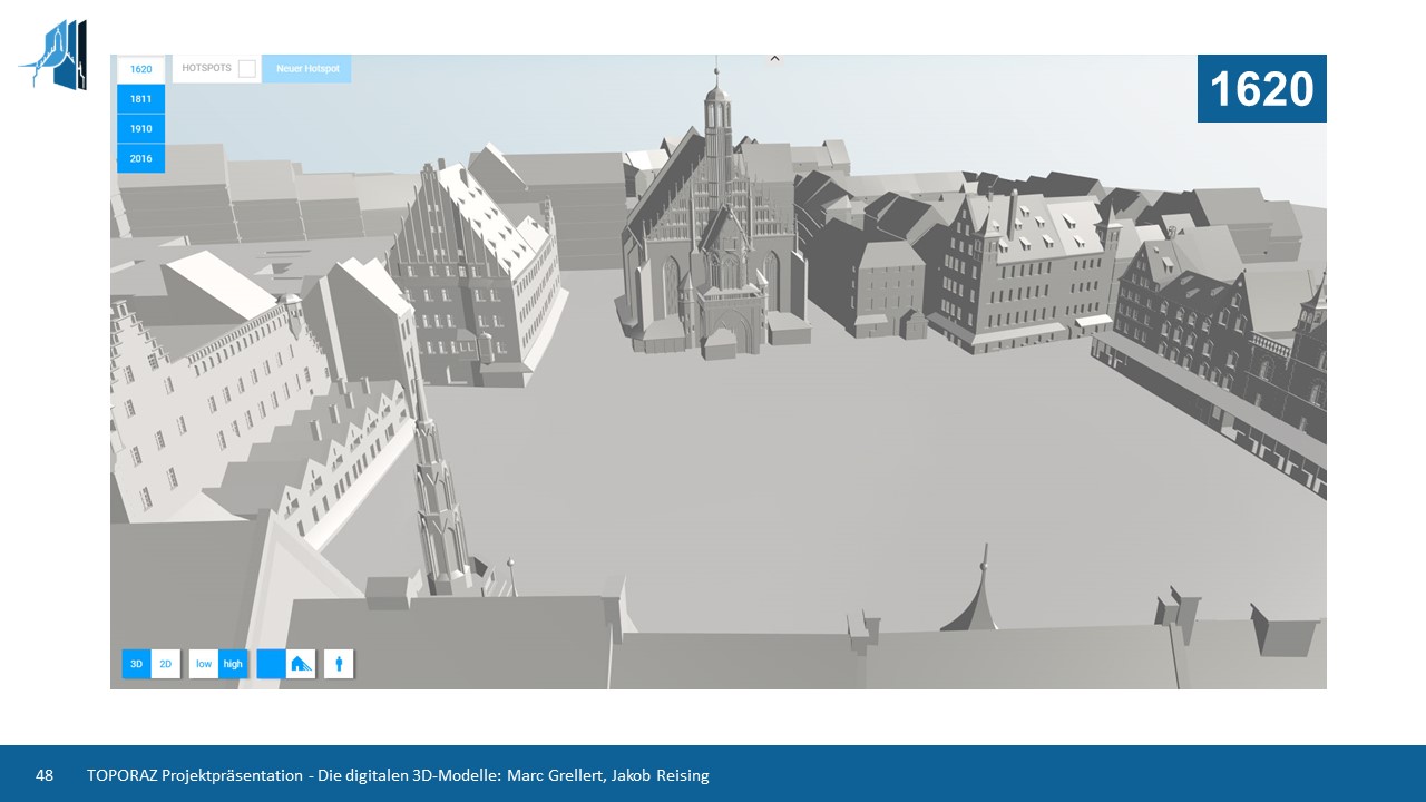
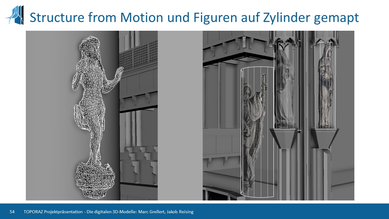
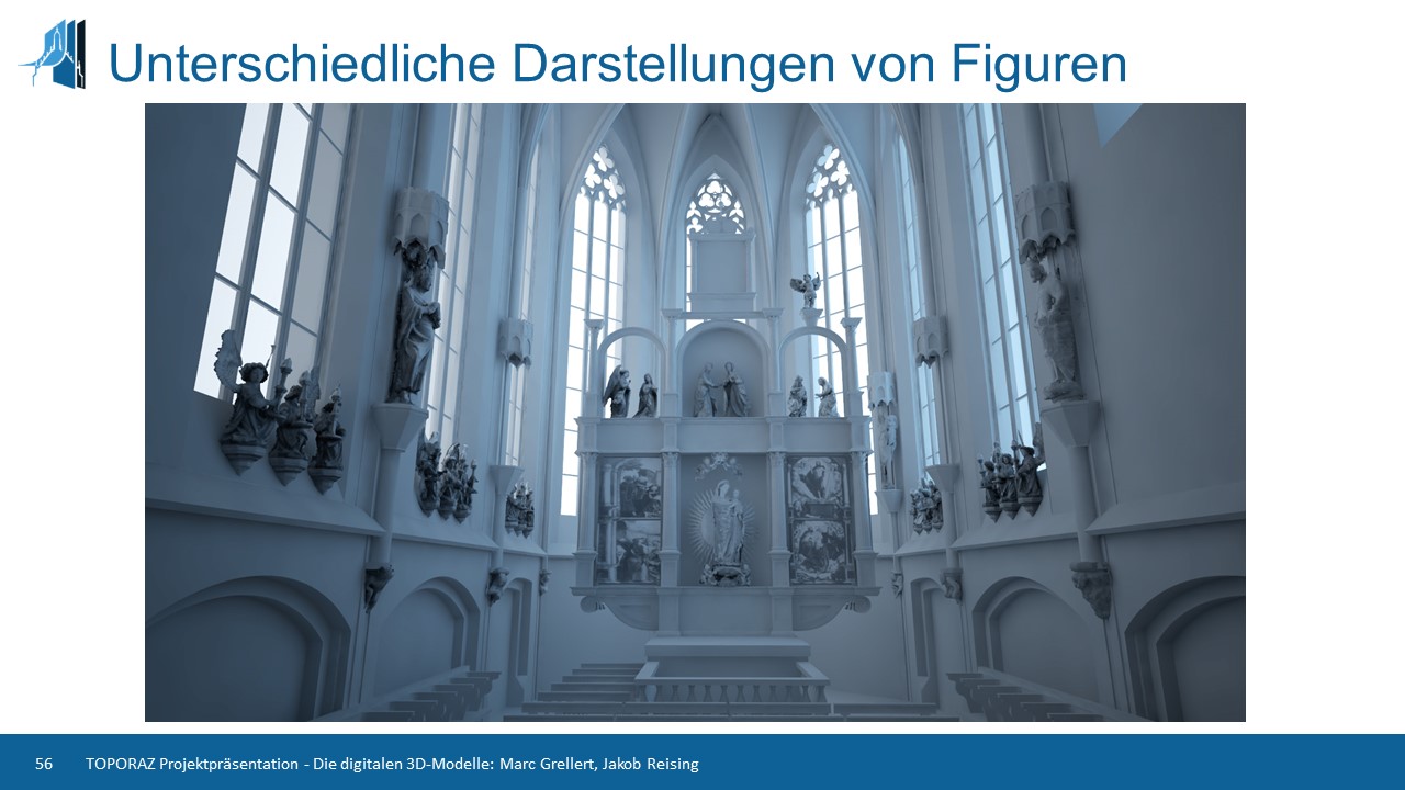
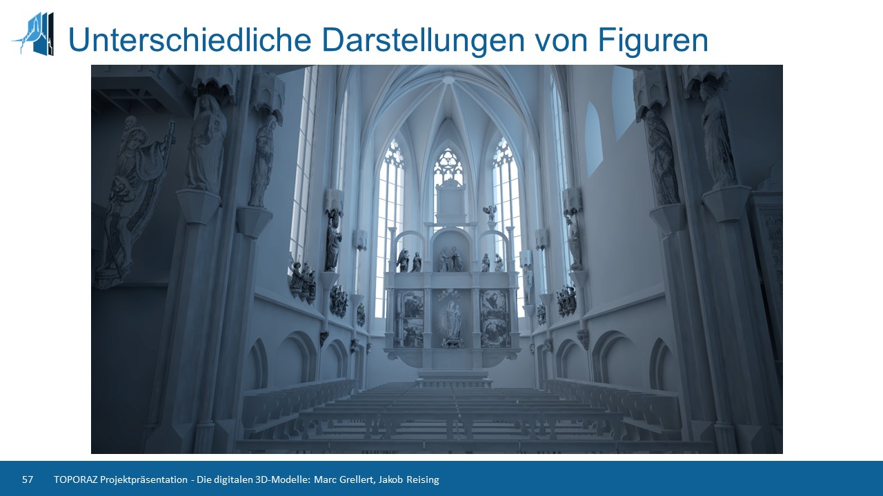
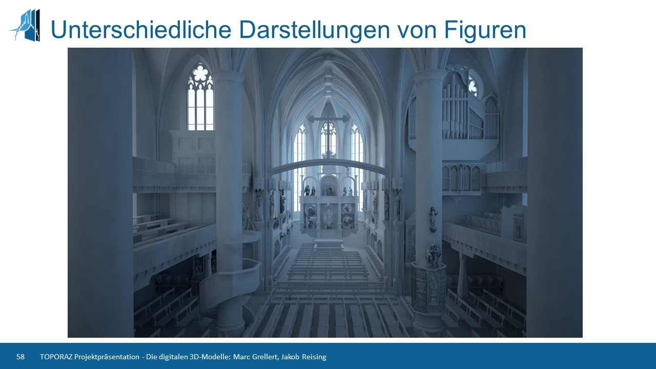
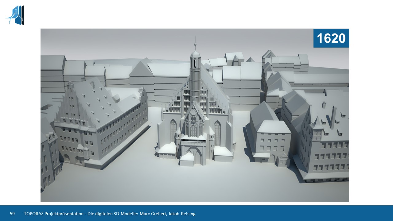
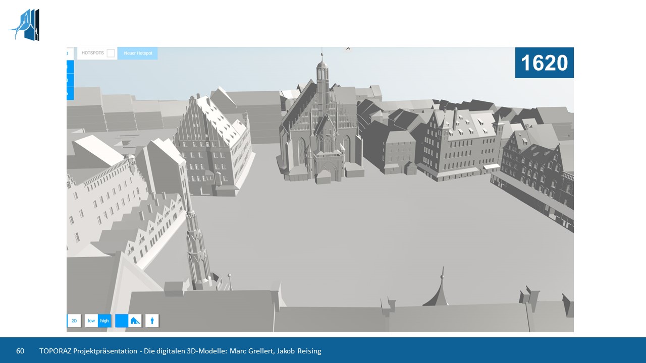
TOPORAZ is a digital space-time model for networked research using the example of Nuremberg. How has a city developed over time? How has the urban space changed? What social networks exist and have existed? Between 2015 and 2018, the development of the virtual research environment TOPORAZ (Topography in Space and Time) attempted to answer such questions using the topographical appearance of a city district in historic Nuremberg as an example. This was done for four different time periods (1620, 1810, 1910 and the present), each consisting of georeferenced 2D maps and 3D models that serve as a navigation structure. The aim of the Digital Design Unit was to create a 3D computer model of a prominent city district in different time periods, which can be used to illustrate historical developments in a differentiated way. The spatial-temporal structure serves as the basis for merging urban objects found in heterogeneous written, visual and audio documents from archives and museums. At the same time, it was made possible to make a stylistic classification of the buildings on the basis of the digitized architecture. For the merging of the urban objects stemming from heterogeneous sources, detailed modelling was not necessary, but only the recognition and differentiation of storeys. In order to achieve a stylistic classification, however, sufficient modelling of basic architectural elements is required. The aim of the project for the Digital Design Unit was to develop a paradigmatic, effort-optimised detailing of the architecture necessary for these tasks.
Digital Design Unit

TOPORAZ
Topography in Space and Time
TOPORAZ
Topography in Space and Time


Contact
Yvonne Machleid

machleid@dg.tu-...
work +49 6151 16-22481